Day 54: Murghab -> Langar
Today was undoubtedly the most challenging riding day of this entire journey. It was also the most fun and thrilling day I’ve had so far. My route goes from Murghab to Langar, a town by the Panj River that serves as a border town with Afghanistan.
About half way through the route, it turns into the Wakhan corridor, which runs alongside the border with Afghanistan (the long panhandle bit which was there since colonial times to serve as a buffer between great powers. This panhandle is also is a dramatic mountain range, the Hindu Kush range, with a snowy peak >7000 MASL). This route is primarily unpaved, and is known to be a challenging ride.
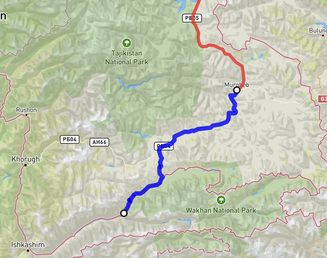 Today’s route in blue
It was an early morning for me, getting up at ~5am ish (after getting to bed early the night before), and polishing off the previous day’s journal entry. By 8am I was getting breakfast with Cornelius, and ready to set off by 9am. First stop was the bazaar at Murghab, for Cornelius to get a SIM card. I figured this wasn’t necessary as most of the places I’ll be going won’t have any cell coverage, and the places that do will either be covered by my esim, or I’ll be able to find wifi.
To my surprise, the bazaar was simply a collection of repurposed shipping containers; these were used as makeshift buildings and stores. It looked somewhat like a small portb with so many containers. I guess this reflects its location:
- it is very very far from manufacturing centres so cost of transportation would be prohibitively expensive (imagine driving a big truck over kyzl art pass)
- the location itself has no energy/industry/building materials/construction equipment (it barely has electricity)
- the region itself is incredibly sparsely populated With such conditions, the easiest and probably the cheapest way is shipping containers (at least until there is a more established trade route via Kyrgyzstan, which has a direct connection with China).
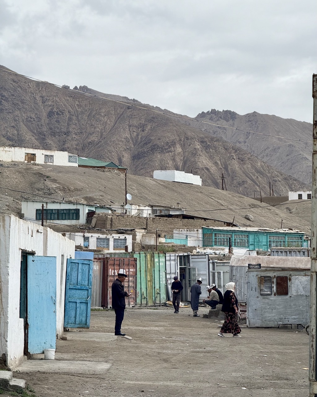 Shipping container bazaar
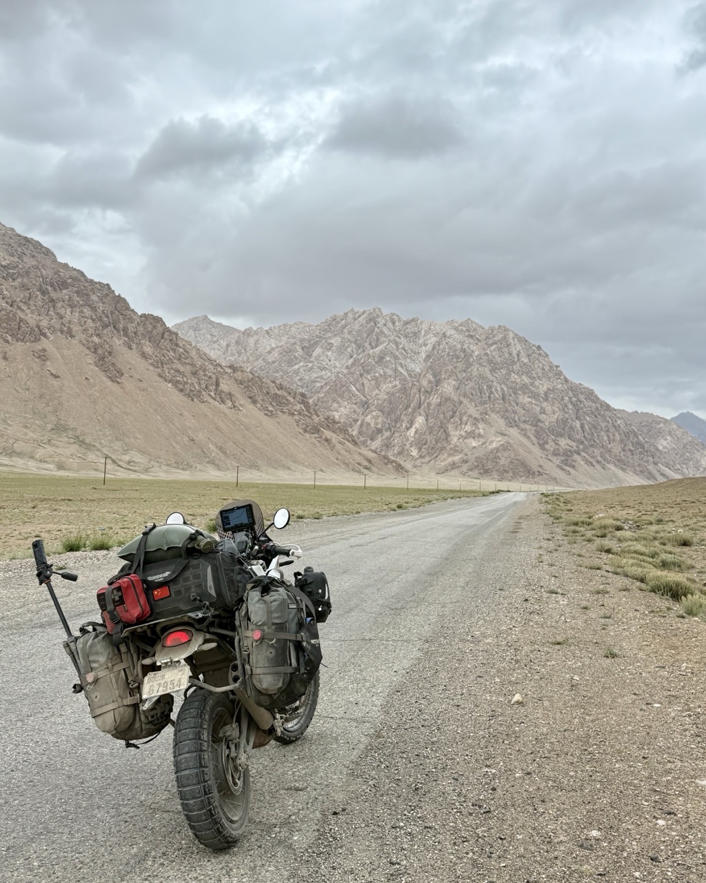
Then we were off, enjoying the road. It was quite fun riding on this road; it is not in good condition with constant potholes and water on the road. I used this as an opportunity to practice an offroad riding technique, where you “float the front wheel” by blipping the throttle and shifting your weight towards the rear wheel. In other words, a (small and controlled) wheelie. This allows the bike to clear potholes which would otherwise have caused a large impact on the front wheel and knocked the bike off balance.
 Just outside Murghab
When in Rally mode, the Desert X is an absolute beast, and does this with ease. I am a complete novice at this, and yet felt quite comfortable doing this over long stretches of road. The only downside is that it tends to use a lot of fuel, which reduces range (which is kinda important in these parts).
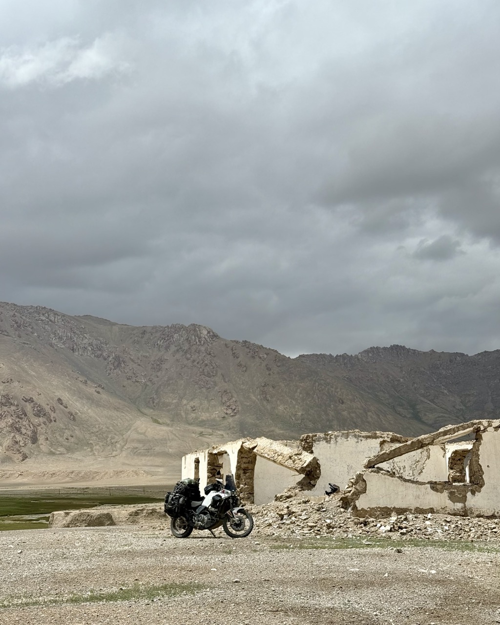 Abandoned building
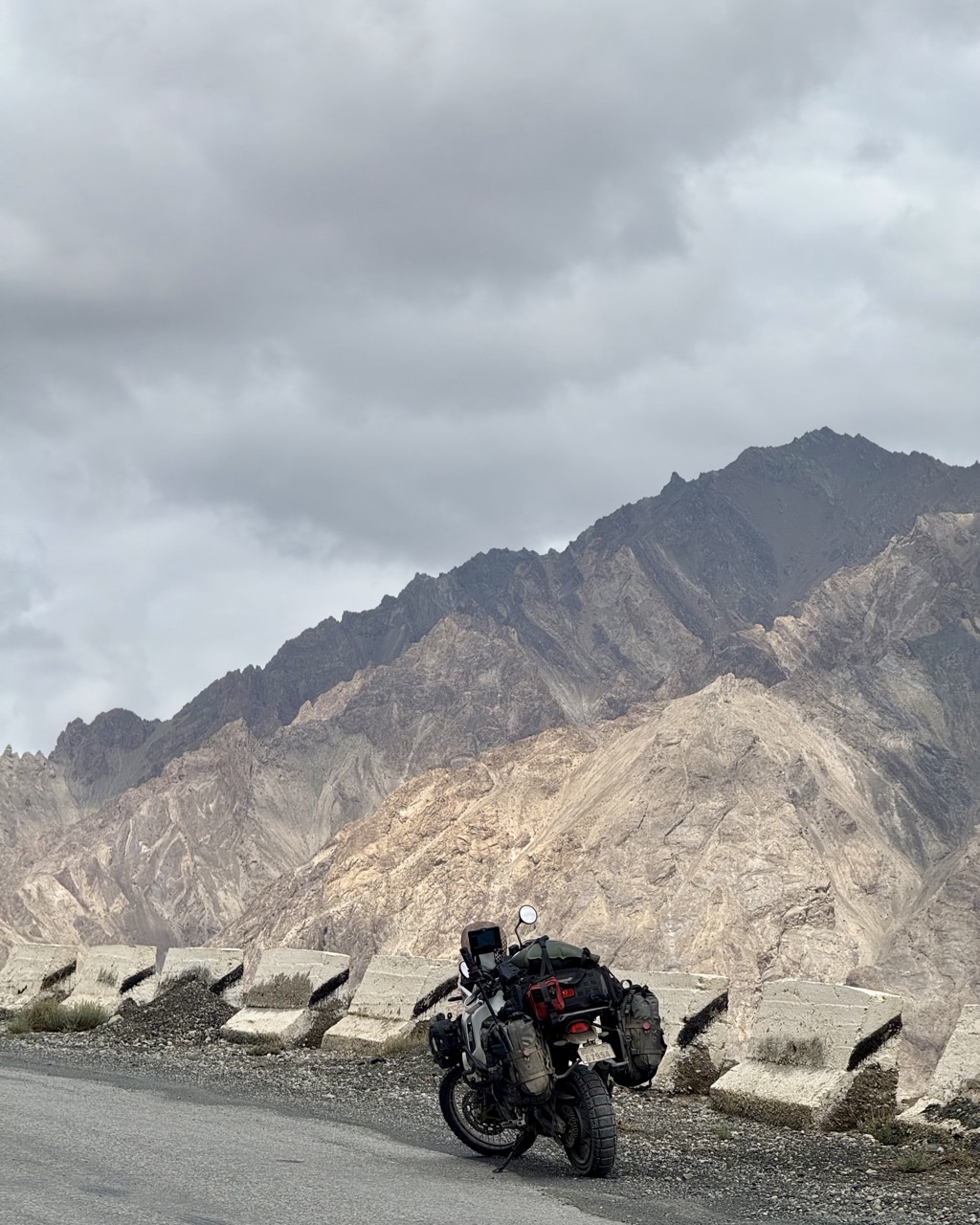
 M41 views
While i had a lot of fun riding these roads, my gps navigator mount did not. For the second time this journey, the mount has catastrophically failed, with the metal torn apart by the vibrations/bumps and the relatively heavy gps unit. I guess it was not designed for offroad riding! The saving grace here is that there is generally only one road to ride along, so it is difficult to get lost.
 M41 views pt 2
Lunch was at Alichur, and was delicious. French fries, meat, and soup.
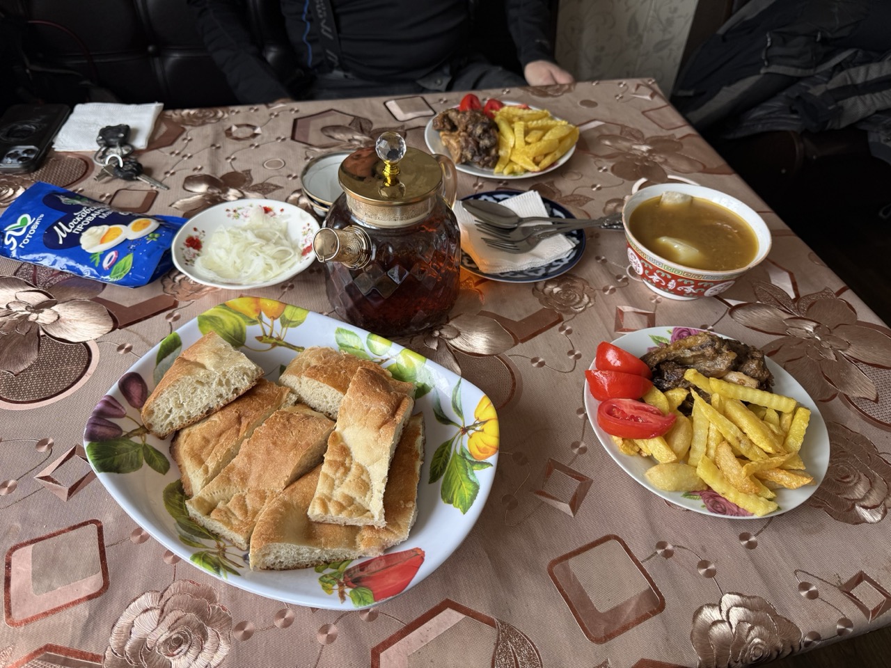 Lunch itself
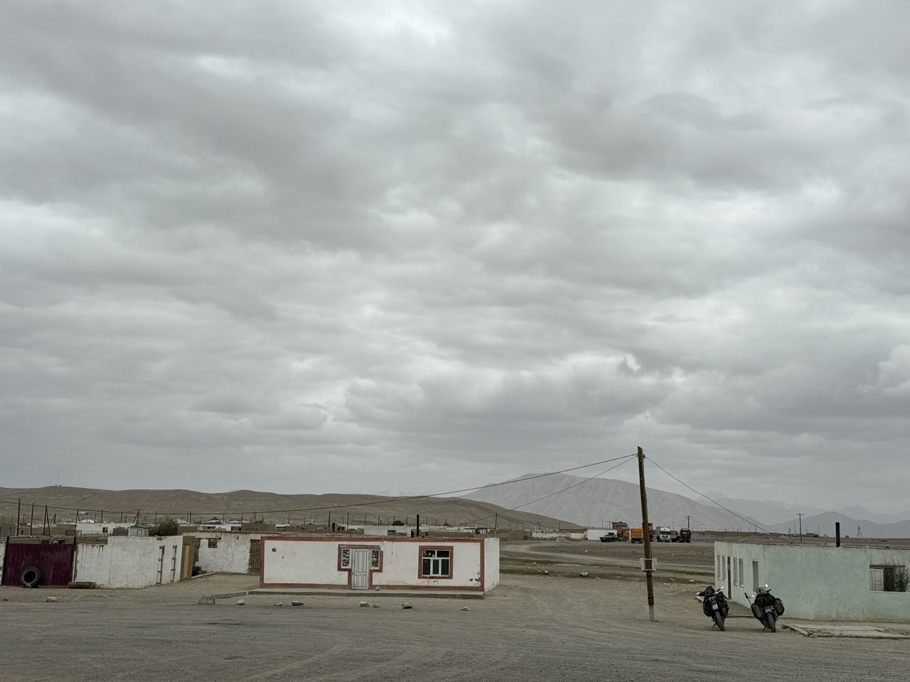 The town of Alichur (quite small, empty and flat)
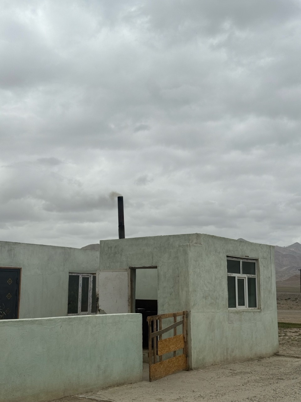 The only sign of life was smoke from the chimney
Funnily enough, while we were eating, we were joined by two Tajik folk. They had been driving electric cars and I had overtaken them long ago. One of them came up to me with a frown on his face and asked me why I flipped him the bird when he gave me a thumbs up. I was very confused, as i don’t remember interacting with him at all…until Cornelius mentioned that he was the one who did that (the guy had tried to stop Cornelius from overtaking him). I was honestly slightly concerned - I am extremely risk averse towards confrontation/adversarial situations with drivers when I am on my bike - but it seemed like the drivers brushed it off.
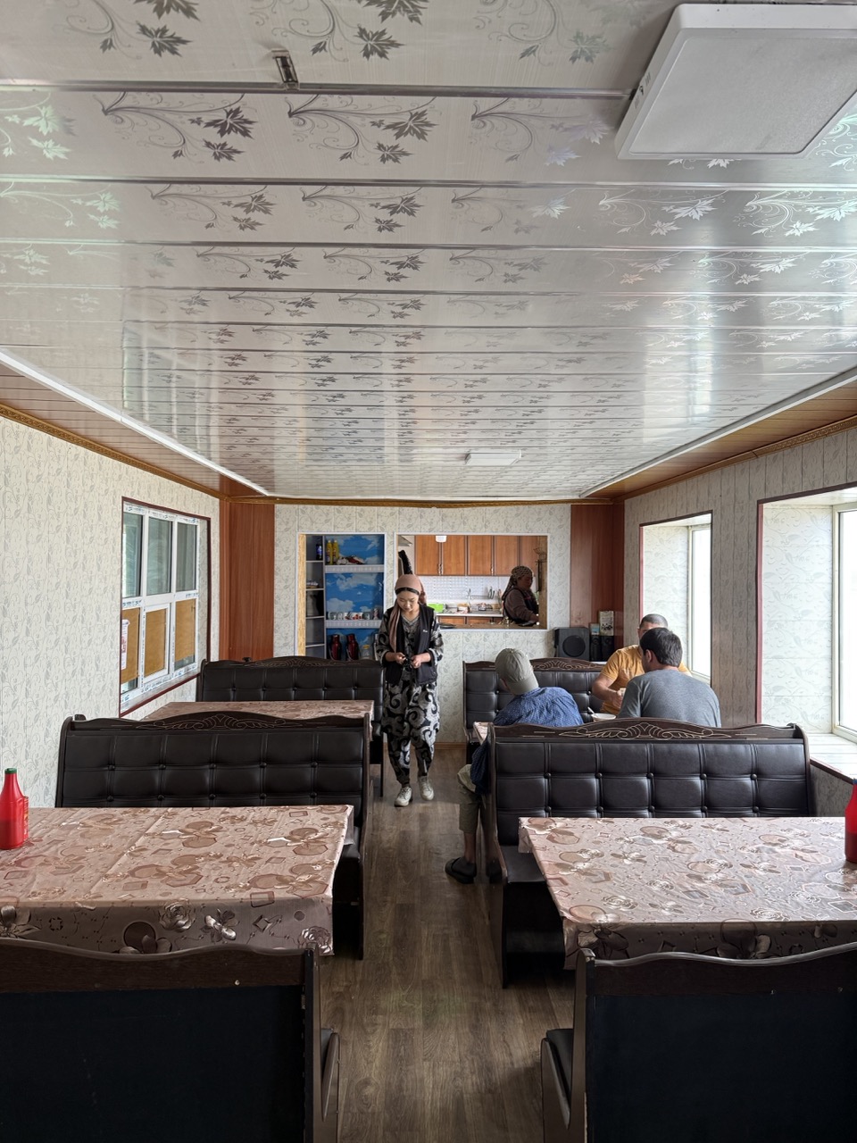 Alichur diner
Cornelius was not feeling too well from the food we had the day before, and had a nap after lunch while I went hunting for supplies (fuel and water). Searching for supplies in these towns is like a game of Chinese whispers. You go to a person on the side of the road and ask in Russian for store (magazin) or fuel (benzin). They will then gesture and you try to interpret what they’re saying (no internet so translators are not so effective), and then head in the general direction. More than once, I was led to a place which others said had fuel, but the owner themselves denied this. In the end, I picked up 5L of water but no fuel.
 Alichur local mafia
Then we set off for the Wakhan Valley. The start of this road was brutal. Kilometres of inescapable ridges that ran horizontally across the road, making the ride incredibly bumpy. I find that above 60KPH, suspension would kick in and smooth the ride. Then came patches of loose gravel and sand, where the ride was constantly on the edge of traction. After about 45 minutes, I passed by a Honda verdadero(?) rider. He was an older pot bellied Russian and had a look of shock on his face, like he had just gone through a harrowing ordeal. I asked him how the road was, and through our translator apps, he mentioned that there was a river crossing that was very difficult to do up ahead. He also mentioned that the road was bumpy the whole way to Khorog (about 3-400kms total i think).
 Entrance of the Wakhan
By now Cornelius had caught up. He had decided to turn back and go the highway route to Khorog; the bumps were not enjoyable, and I guess it wasn’t the best thing to be doing while feeling ill (especially in super remote parts like the Wakhan).
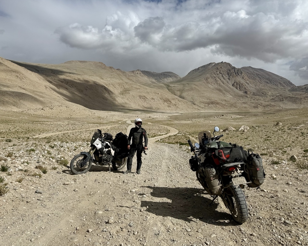 Farewell to Cornelius!
I then had a decision to make. To continue, or to turn back. I decided that I could always ride to the river crossing, check it out, and if it is too difficult, turn back.
And so I continued, back to riding alone.
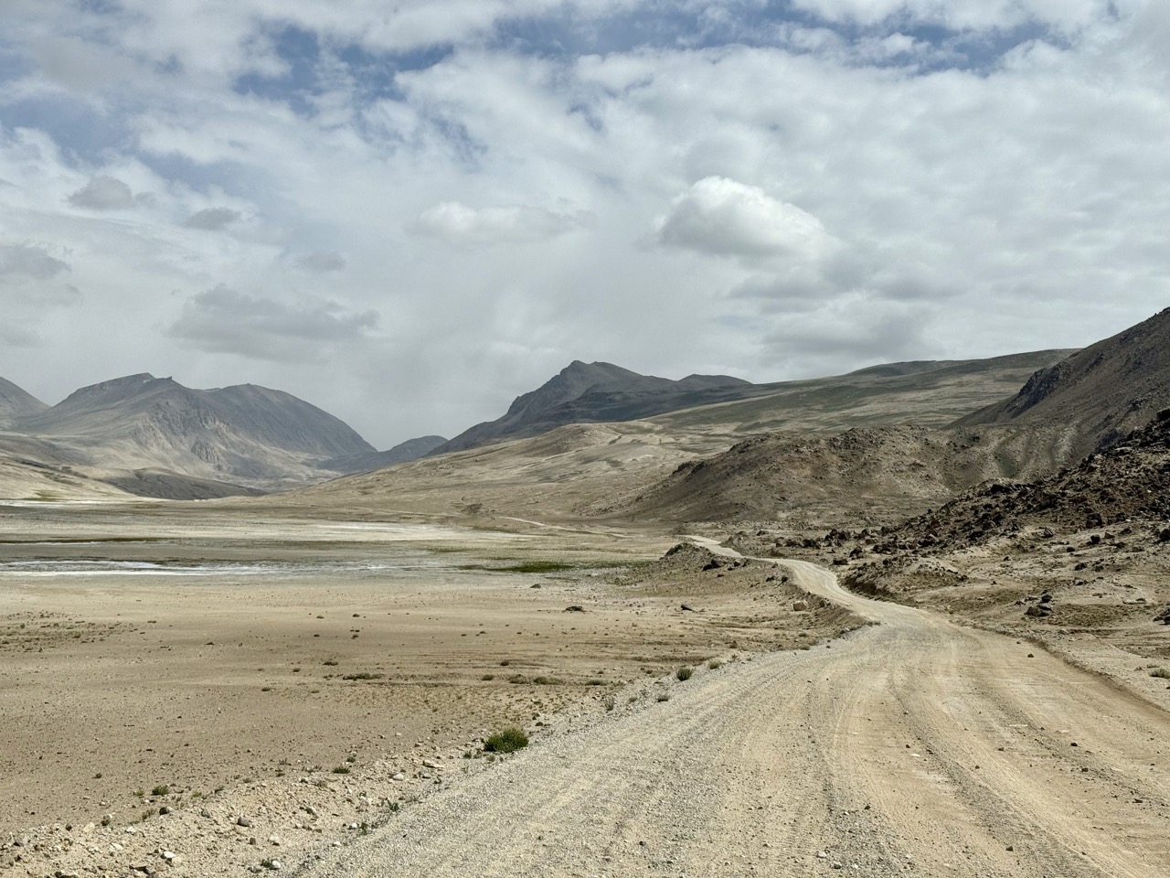
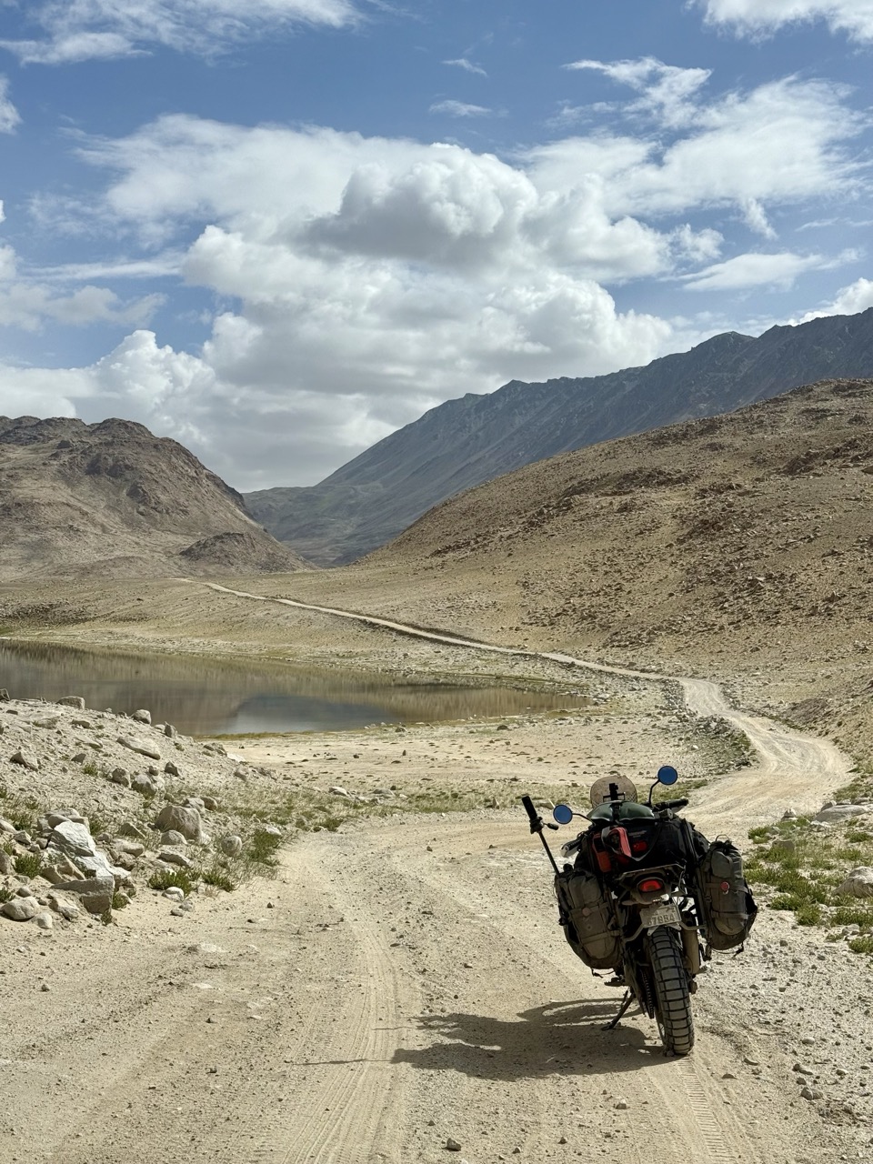 The lone road ahead
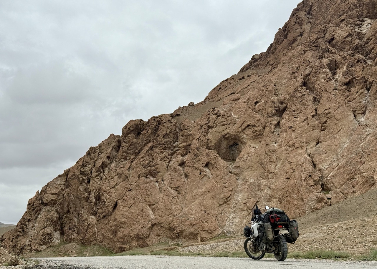
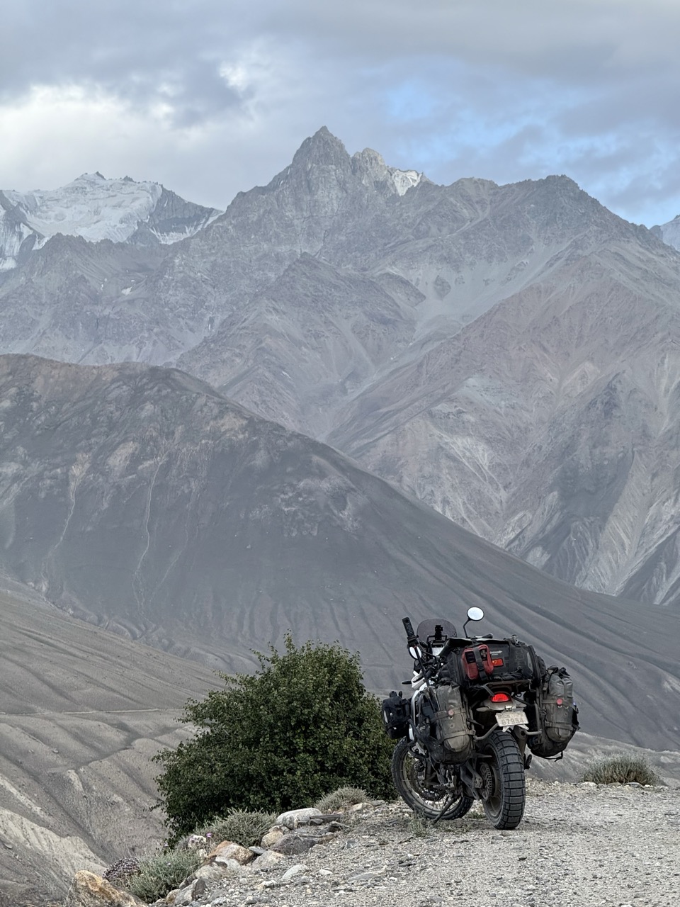
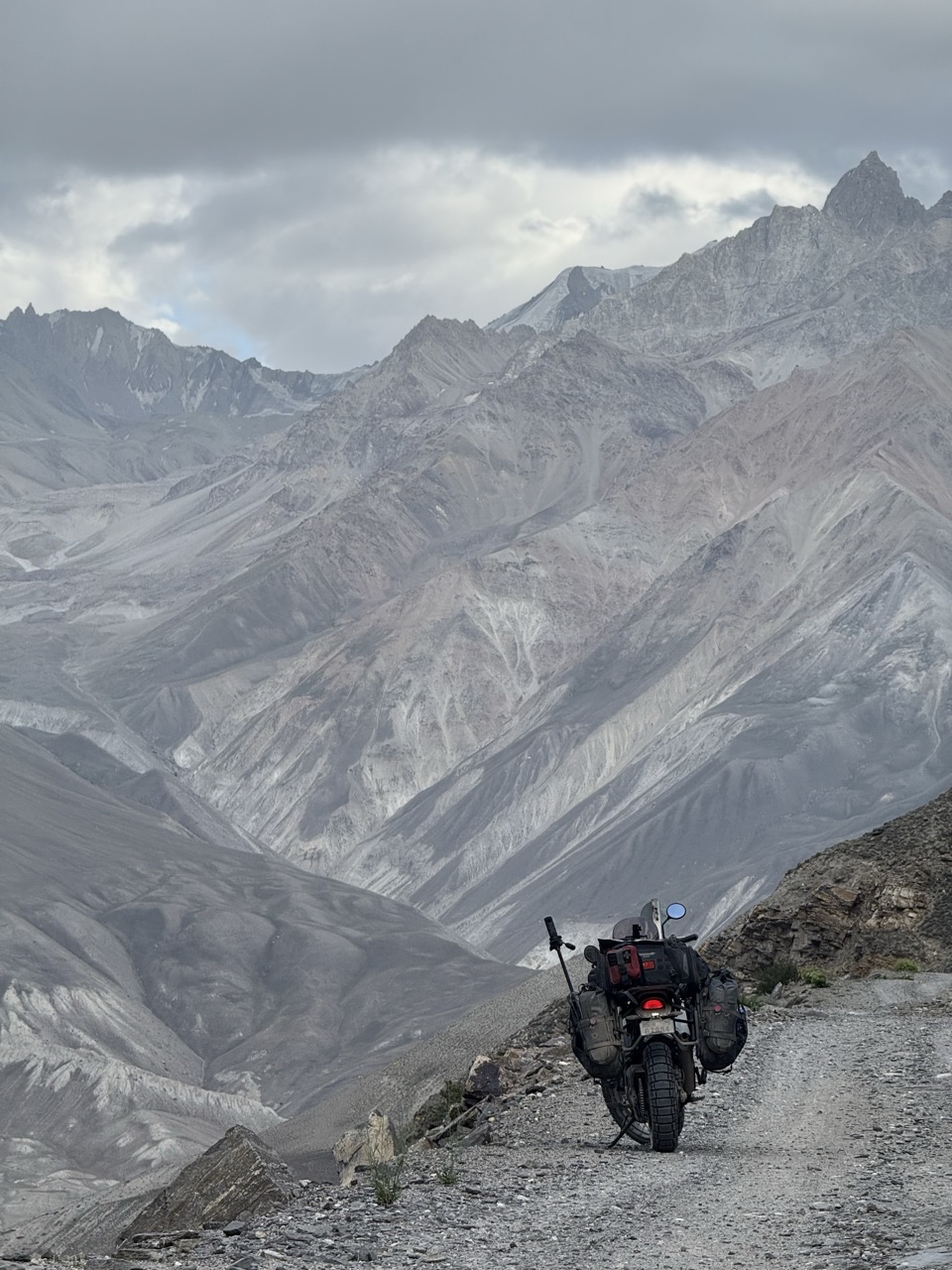
The next few hours were extremely exhilarating and gave me a newfound respect for what Ducati have created with the Desert X. It performs extremely well off pavement, very manoeuvrable and with plenty of power. For much of the riding, the road was the literal edge of a cliff, with the roaring river tens or hundreds of metres below. On the other side of the valley was Afghanistan, where spectacular mountains lay.
 Wakhan pt 1
 Wakhan pt 2
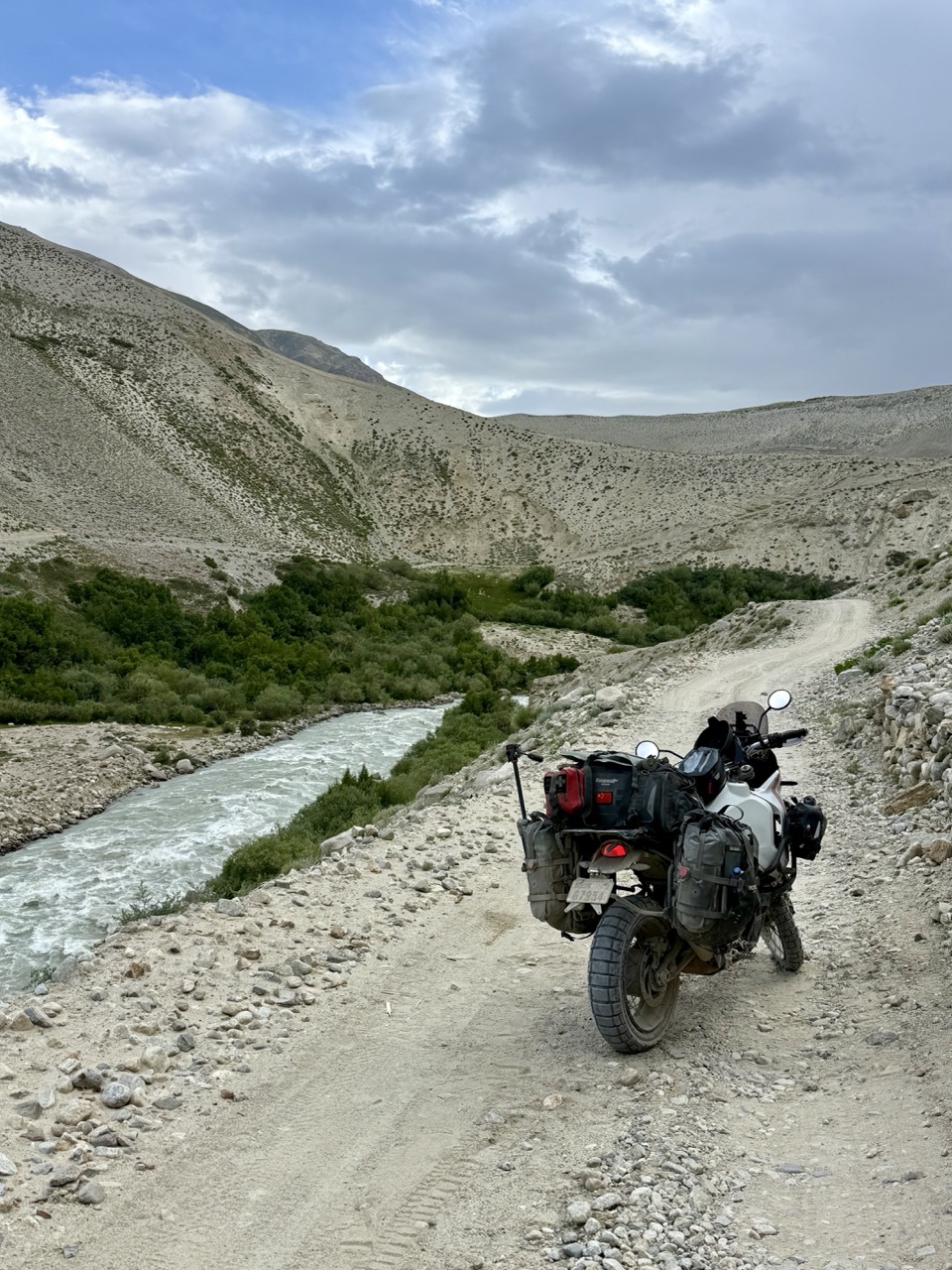 Cliffside road
There were sections of sand where I felt like I was in a fight with the road for traction, responding to each and every “move” thrown at me.
Other sections the cliffside path was covered by rock slides, with a sloped bed of large fist sized rocks complicating the way.
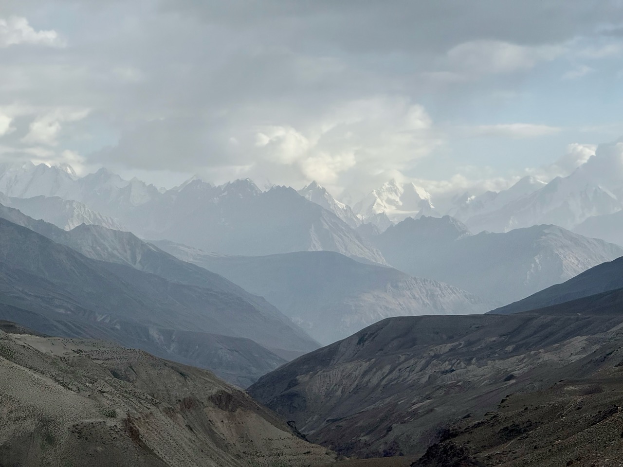 Hindu Kush mountains
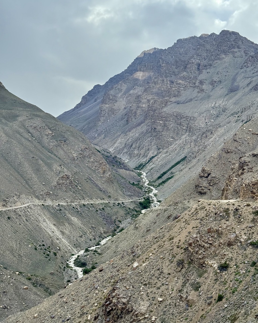 Notice how the river cuts past the road
Eventually i passed by a few people who had set up camp by the river at a rare patch of grass. I stopped and they walked over to say hello. They were two Aussies, who could have been father and son, riding DRZ650s from Italy to Nepal. They had come from the other way and had crossed the river a few hours earlier. “Yeah nah, you’ll be right mate, piece of piss” when I asked about it. Quite a contrast from the Russian who looked like he had seen a ghost! I decided that the water flow had probably been different now vs in the morning when the Russian had crossed, and that it was worthwhile checking out and having a crack.
The next hour or so was spent in a sort of tension between wanting to stop for photos in the dying light (it was fast approaching sunset), and wanting to get to the river crossing with enough daylight to spare.
 Cliffside photo op
 Unbeatable backdrop
When i finally reached the river crossing, I understood what had happened. The old bridge along the highway had collapsed, and there had been a makeshift detour constructed that went up the river about 100m, where there was room for a shallow crossing across two pipes which channeled much of the water. I mapped out the path across, testing depth with my camera tripod. I don’t think any part exceeded 30-40cm in depth, so long as i stuck to the shallow path.
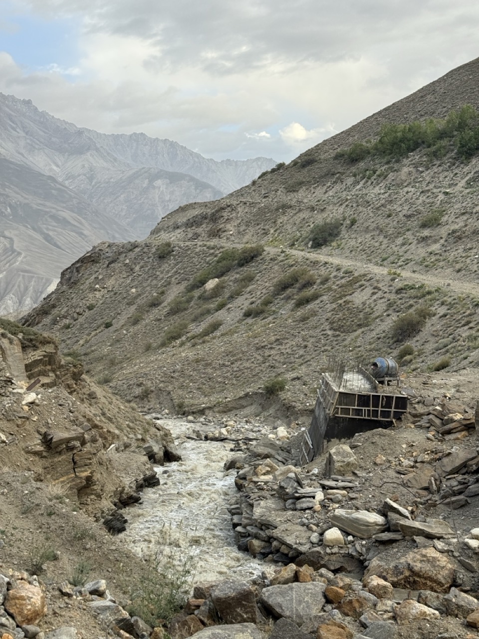 Broken bridge
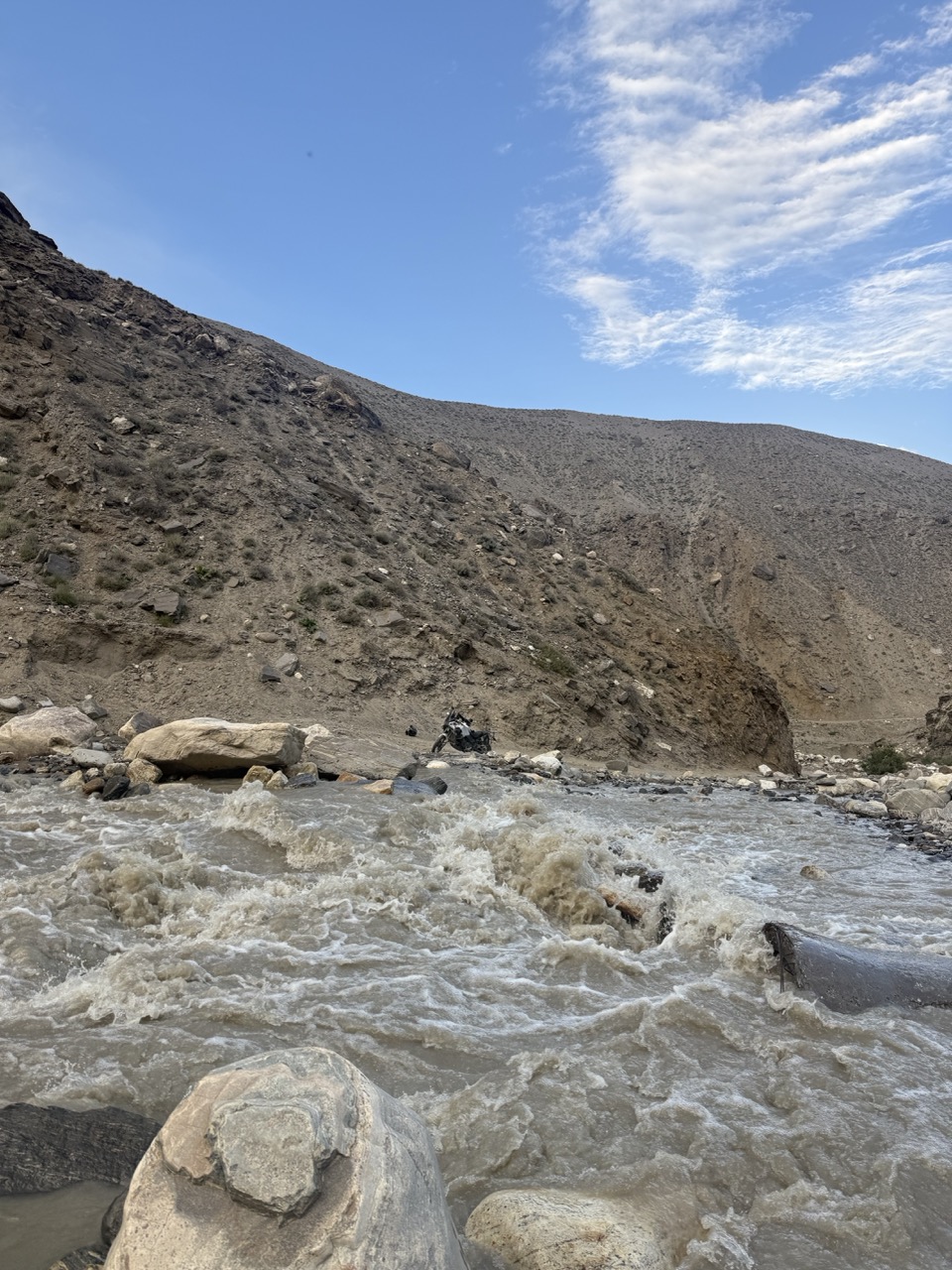 The river crossing
It was tough work at altitude, going back and forth across the river and carrying my luggage to the other side - when I was finally done I decided to have a crack at it. Sans jacket (in case i fell and got drenched), but with the Buddhist charms I had purchased in Tibetan areas adorned for luck and protection.
I was extremely pleased with myself when i made it over without any issues.
 Made it!!!
I decided to go and check out potential camping spots up a steep and rocky path above the river on my bike…this was a bit of a mistake. By the time I realised that it did not lead anywhere interesting, i stopped and it was a bit too difficult to turn around. I ended up planting the rear into the ground, so had to gently tip over my bike and try to manoeuvre it to a viable part of ground.
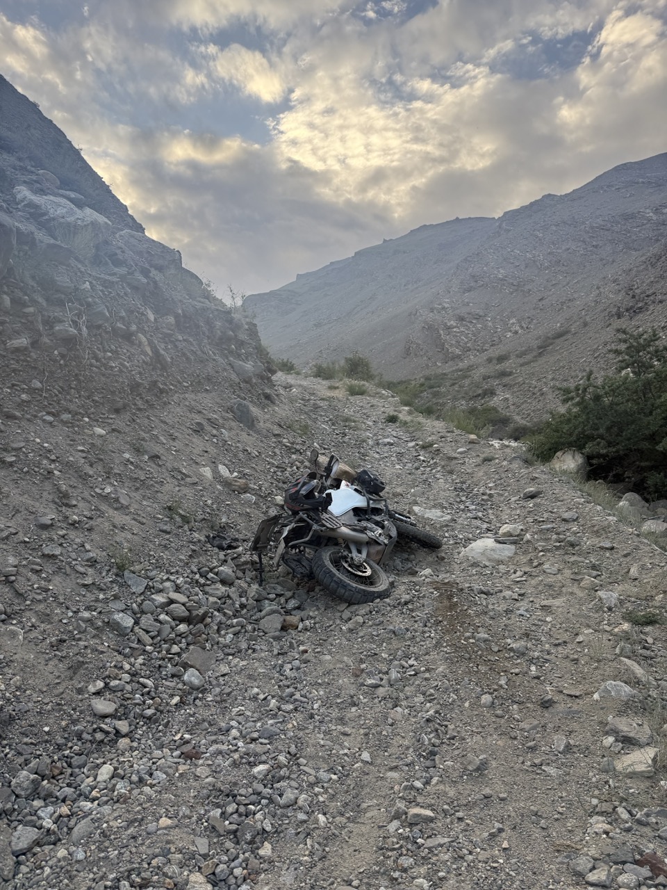 Oopsie
This whole exercise took quite a while, and I ended up dropping and picking up my bike several times before I was able to return to the road.
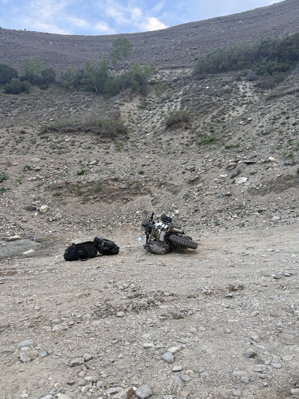 Oopsie pt 2 (and 3,4,5,6)
Exhausted, I decided to continue on to town, and started putting my luggage onto the bike once more…until the dirt beneath the kickstand gave way and the bike tipped over again!
It was at this point that i decided to give up and camp by the road, even though it was rocky and probably not super comfortable. Halfway through setting up a tent, a land cruiser came by and attempted the river crossing. It was a Tajik driver with two Swedish lads in the back. I helped guide them through, and then asked for them to help me in picking up my bike (i had completely given up and decided to pick my bike up in the morning earlier).
Right before they left, the driver said “the next town is only 15km away…you’ll be there in 20 minutes and there’s lots of homestays to have a good rest and food.
It probably wasn’t wise, but this was the second wind i needed to keep going. I packed up my tent quickly, remounted luggage to my bike, and took off. It was late dusk by now, and the light was fading away, so I ended up using my auxiliary lights from Xi’an.
I was so very grateful for having gotten these lights because they were the difference between seeing the path and all the rocks that lay ahead, and riding semi blind.
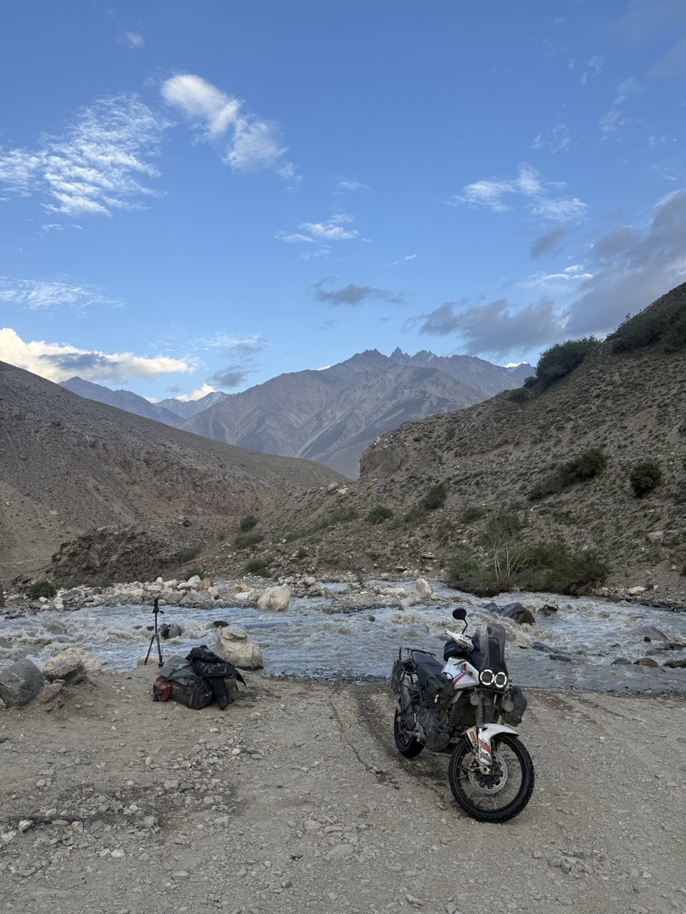
About 45 minutes and a few more tip overs later I made it to the town of Langar, exhausted but relieved.
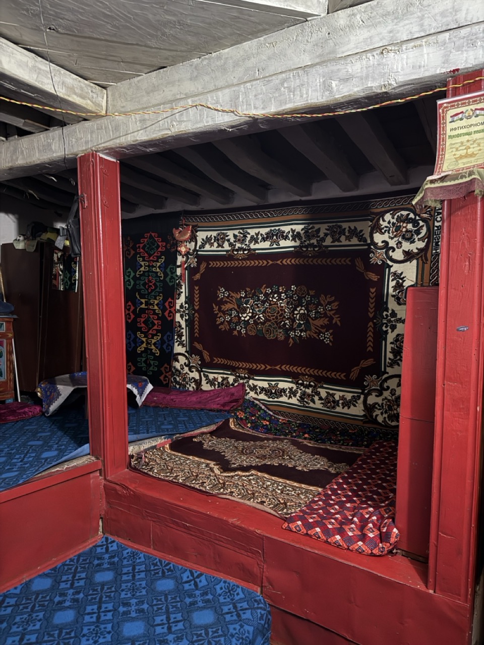 Tonight’s lodging
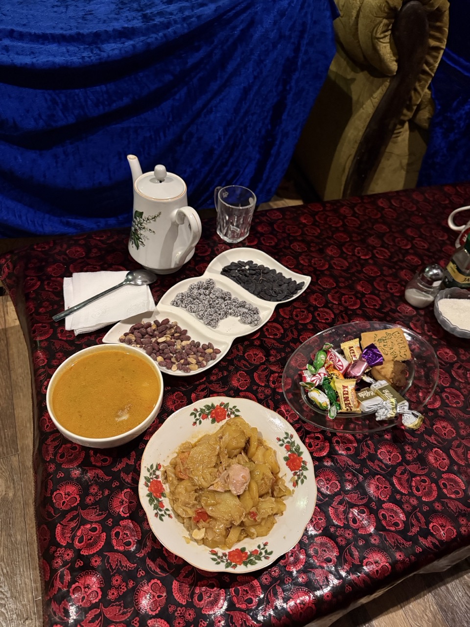 Warm Tajik dinner
Tomorrow; Khorog!
Some stats:
- 243KMs traveled
- 13.7L fuel added
- 20g coffee consumed
- 10 unique interactions
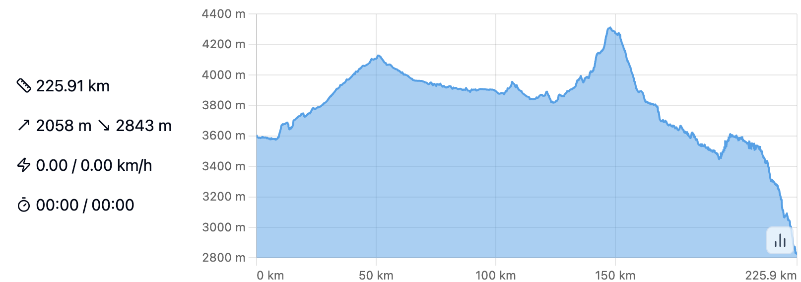 Altitude map of today’s ride
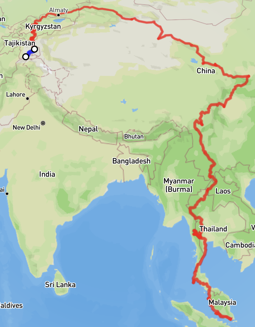 Route to date